Swipe up and down through an organized grid of nearby transit routes
Set your favorite routes and they'll appear at the top for quick access
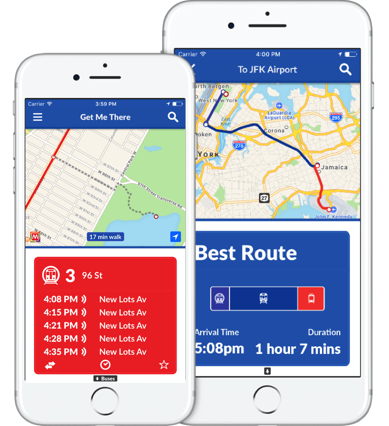
View a route's schedule over the next two days

Realtime correction for most agencies that support it
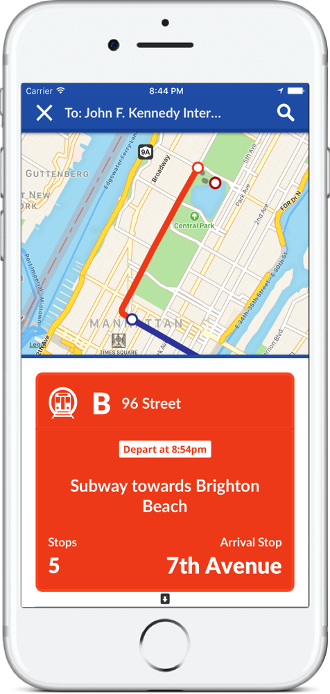
View your entire route on the map while also stepping through trip by trip
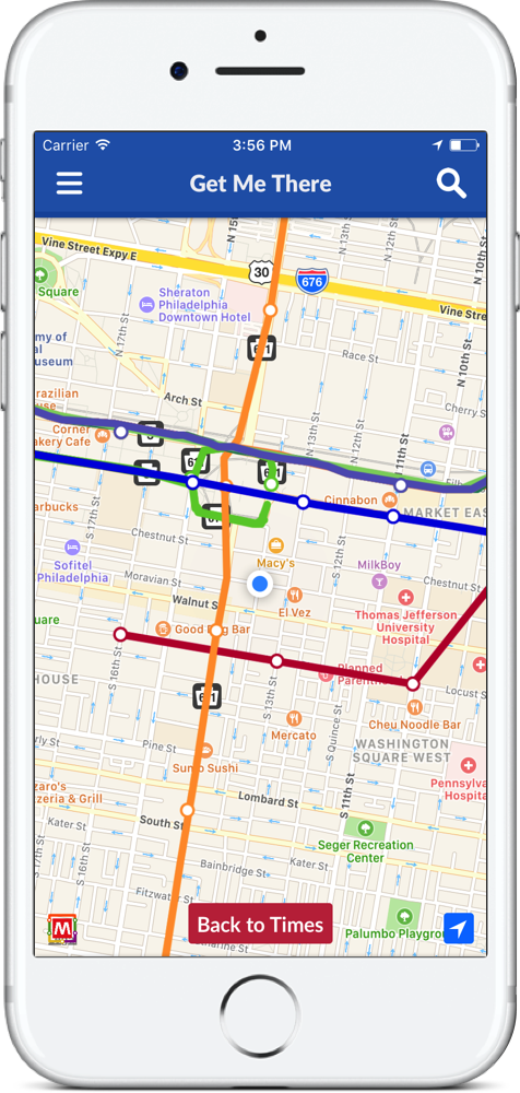
Look at a transit map of your entire city. Tap any location to see nearby routes
Want to know the quickest route from point A to B? Search across multiple transit agencies in realtime with Get Me There transit directions
Place your location in the middle of the subway map, and see true distances to the nearest stations. Tap anywhere on the map to see the nearby routes, or tap a station to see which routes stop there.